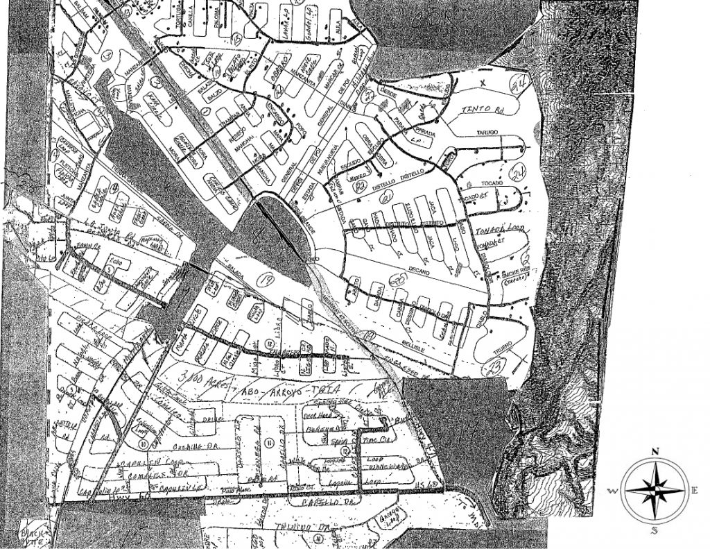
ALL plat / Unit maps were accepted by Board of County Commissioners for Valencia and/or Socorro County in 1972-1973
The following plat maps are in Adobe PDF format.
Unit 1 | Unit 2 | Unit 3 | Unit 4 | Unit 5 | Unit 9 | Unit 10 | Unit 11 | Unit 12
Unit 13 | Unit 14 | Unit 15 (inactive) | Unit 16 (inactive) | Unit 17 (inactive) | Unit 18 | Unit 19 (inactive)| Unit 20 | Unit 21 | Unit 22 | Unit 23 | Unit 24
Map of Tierra Grande
Note: This map is not to scale and a rough approximation created to let interested people know what is in Tierra Grande.
Heavy Black Lines are Power Lines
Circled Numbers are Units within Tierra Grande
Dots are Homes
Dotted Lines from northwest to southeast show the approximate
route of the railroad
The line between asterisks is the Valencia County/ Socorro County line
All roads reflected on the plat maps are “public roads”. Tierra Grande does not own or maintain them

